Federal School of Surveying, Oyo.
CARTOGRAPHY & GIS DEPARTMENT
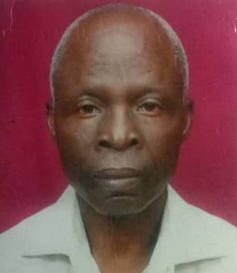
Head of Department, Cartography & GIS)
- Dada, FOA.
PhD.(Cartography)
foadada@yahoo.com
2348036051683, 08026789623
History
The NBTE visited FSS OYO from March 2 – 7, 2020 to accredit the new Department of Cartography and GIS but the history of Cartography at F.S.S. is older than its beginning. The thought of it had existed as far back as mid 1960s.
In the Minutes of the Nigerian Survey Conference of 1966 held at Ibadan, Chaired by Mr. R.O. Coker, Director of Federal Surveys, Chief A.O. Morgan, M.O.N., Assistant Surveyor General of Western Nigerian Surveys, suggested that there should be a Department for Surveying research that would undertake research into new developments and the use of Surveying and Cartographic materials in the country. Chief Morgan expressed dissatisfaction with the lack of study of the best materials available. He noted that the market was full with very many Cartographic materials but without any effort to find out which of them would best suit our purpose in the country. He said the site for this could be anywhere in Nigeria best suitable for it. A study of the effect of climatic conditions on drawing materials would be of great interest.
Mr. Noailles, H.O.D. of Survey in Nsukka University, supported the idea and said he had such an experimental station. Mr. Horsfall, Air Survey Officer (Federal) supported the idea of Research Unit but asked if any serious programme of training had been embarked upon by the various survey Departments for Cartographers of the right caliber. He felt before setting up a Department for research into Cartographic materials, the Cartographer of the right caliber to undertake such research should first be trained. Mr. S.J. Ojeikere, Acting Principal Surveyor, Mid-Western Nigerian Surveys, remarked that he was aware that Mr. Howells, Principal School of Surveying, Oyo, was already encouraging research into fields methods. Mr. Howells confirmed that there were qualified staffs to undertake the research, it only remained money and materials at Oyo School.
The course structure is meant for 12 months calendar and is full time. The first (1st) module will introduce the students to the basic course while the second (2nd) module is all about Spatial Acquisition. Module three (3) will expose the students to Spatial Database Management we also expect that the projecis suoervision will commence this third (3rd) module. Moduke four (4) which is the final module is all about application i.e diverse ways /fields of applicability of Geographic Information System (GIS). On the successful completion of all the modules, the remaining months of the course will lead you to undertake a research project,examining in depth a particular topic relevant to work or interests. The students will identify an appropriate sustainabgle management issue to investigate, develop a proposal that details your research methods; carry out a literature review, and apply the theory and practicals you have learned to produce a citically informed analysis.
Mr. Ojeikere concluded by suggesting the creation of a research Department in the Federal Surveys. This was not with prejudice to the Advanced Certificate in Cartography Course being run by the Federal Surveys. The first batch ran from 1st June to 30th Nov. 1965, in which 17 students (8 Federal, 3 from the North, 2 from the West, 3 from the East, and I from Ife University) graduated.
With reference to the Cartographers of the right caliber suggested by Mr. Horsfall, as far back as 1966, the initiative of the present Rector of FSS, Dr. Nihinlola Olaynika Dosumu in establishing a Department of Cartography and GIS is a right step in the right direction.
Vision
Department of Cartography and Geographical Information System is pursuing a new paradigm shift in the field of Cartography. There is opportunity now for Cartography to benefit greatly from the emergence of GIS to enhance its products. The programme will produce people with ND in Cartography and GIS and HND in Cartography and GIS.
Such graduates who come from combined Geoinformation system and Cartography will be useful for the Nation in planning decision – making and policy formulations as well as in research activities. Automation is an integral part of many modern mapping activities. The operation of digital mapping will certainly relieve the Cartographer of painstaking repetitive tasks but it has not decreased the demand for Cartographers. In fact, the demand has increased for those who can identify those areas that can be efficiently automated and can implement suitable techniques. Computer is useful for the construction of projections and the compilation of base information. It is useful for the processing of remote sensing and statistical data. It can be used to generalize map information and can be used for the production of a finished map in various forms, complete with symbols and lettering. Computer driven plotters on paper or film now produce coloured maps directly from digital files.
In the Federal and States Scheme of Service, graduates of our programme will fit into the group of Cartographic Technicians/Technologists and Cartographers. While the Technicians/Technologists will be involved in the practical construction of maps and editorial checking, those who go higher will perform professional work like conceptualization of maps, the gathering and evaluating of mappable data, design and evaluation of the final product. They will be able to produce maps, charts, and special graphics from information supplied by field surveys, aerial photography and remote sensing, existing maps and other sources of physical, economic, social and cultural data.
The Department of Cartography & GIS comprises of two academic units namely:
Dr. Dada, FOA Head of Department, Cartography & GIS (+2348036051683, 08026789623), (foadada@yahoo.com)
School Calendar Events
-
FEB12
1st Sem.Lectures
2nd Sem. 23/24 Sess. Lectures Starts
-
MAR28
End of Registration
2nd Sem. 23/24 registration closes
|
|
|
|